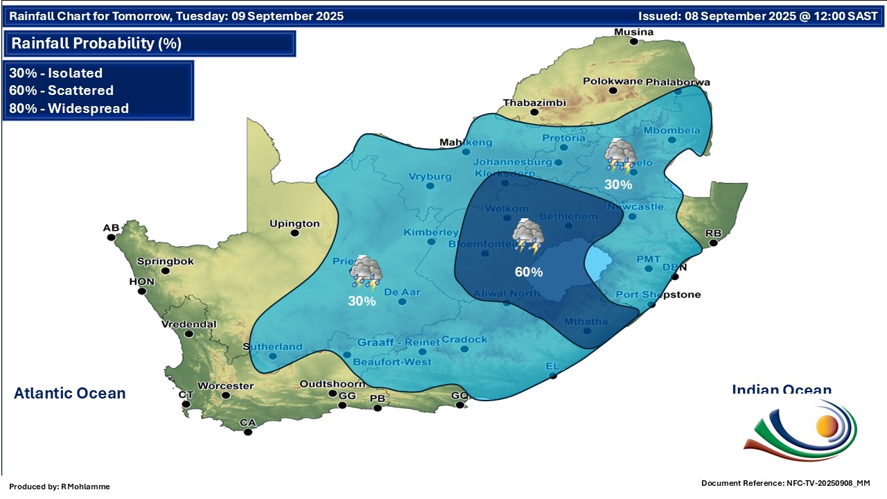
GARDEN ROUTE | KAROO NEWS - The South African Weather Service (SAWS) has advised that extremely high fire danger conditions are expected in places over the central and northern parts of South Africa on Tuesday 9 September.
SAWS has also issued a yellow level 2 warning for severe thunderstorms accompanied by strong winds, excessive lightning and hail which may lead to damage or loss of infrastructure, settlements, vehicles and major travel disruptions for the eastern and south-eastern parts of the Free State, north-western parts of KwaZulu Natal and the eastern parts of the Eastern Cape.
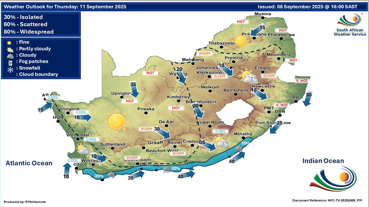
Regional forecast:
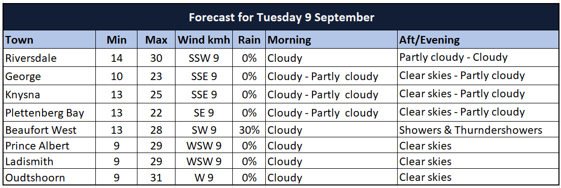
Western Cape
Morning fog patches in places, otherwise partly cloudy and cool to warm with isolated showers and thundershowers over the north-eastern parts in the afternoon. The wind along the coast will be fresh to strong easterly to north-easterly along the south coast, otherwise moderate to fresh westerly to north-westerly.
The expected UVB sunburn index: Moderate
Western half of the Eastern Cape
Morning fog patches, otherwise partly cloudy and warm to hot with isolated thundershowers over the northern and eastern parts. The wind along the coast will be moderate to fresh easterly.
Eastern half of the Eastern Cape
Cloudy, windy and warm with isolated showers and thundershowers, but scattered in the east.
The wind along the coast will be moderate to fresh north-easterly.
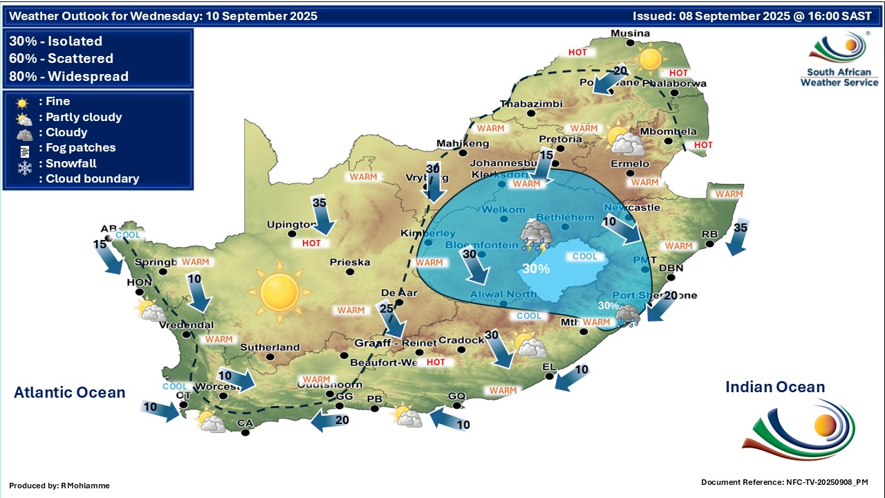
Extended weather forecast:
‘We bring you the latest Garden Route, Hessequa, Karoo news’