
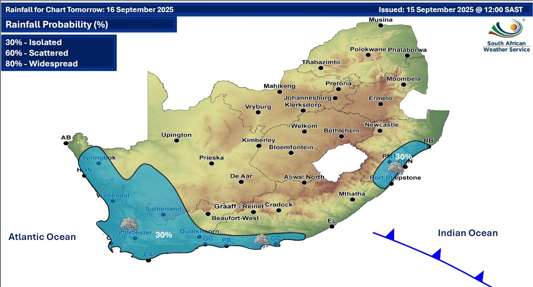
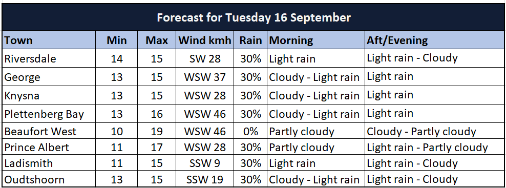
GARDEN ROUTE | KAROO NEWS - Isolated showers and thundershowers are expected over the south western parts of the country on Tuesday, with possible damaging winds and destructive waves along the east and south coast of the country.
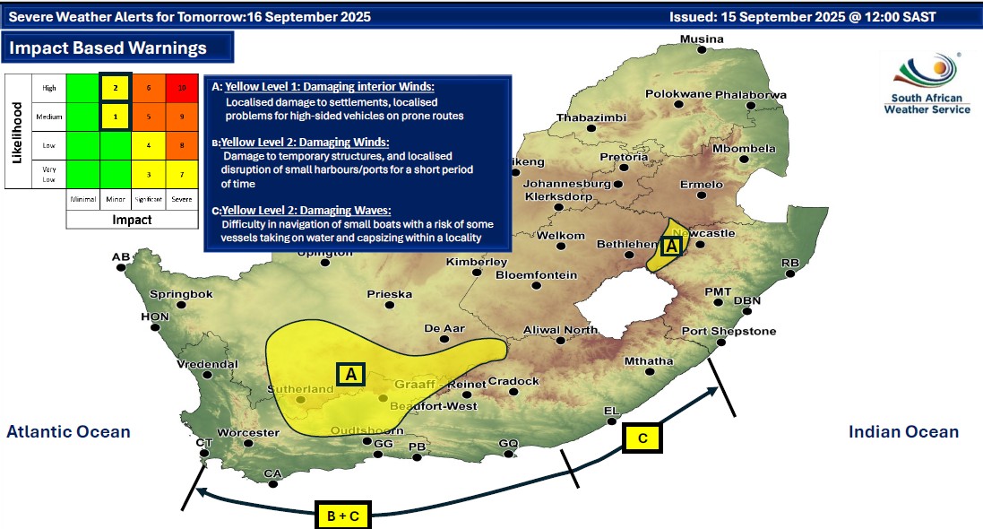
Impact based warnings
A. Yellow level 1 warning - damaging interior winds leading to increased travel times and localised problems for high sided vehicles on prone roads are expected over the Karoo Hoogland (N. Cape) and the Central Karoo (W. Cape) on Tuesday early morning.
B. Yellow level 2 warning - damaging winds and waves leading to difficulty in navigation at sea, and small vessels at risk of taking on water and capsizing, are expected between Cape Point and Plettenberg Bay. The winds are expected to moderate from Tuesday evening, while the waves persist until Wednesday morning.
Regional weather forecast
Western Cape
Partly cloudy and cold to cool with light rain except over the north-eastern parts, clearing from the west in the afternoon. The wind along the coast will be moderate to fresh southerly to south-westerly but strong to strong along the south-western and southern coast in the morning. It will be moderate to fresh north-westerly along the west coast in the morning.
The expected UVB sunburn index: Moderate
Western half of the Eastern Cape
Cloudy along the coast and adjacent interior with isolated showers and rain, otherwise partly cloudy and cool, but fine in the north. It will be windy over the interior in the morning. The wind along the coast will be strong to gale force south-westerly.
Eastern half of the Eastern Cape
Partly cloudy, windy and cool. The wind along the coast will be strong to near gale force south-westerly.
‘We bring you the latest Garden Route, Hessequa, Karoo news’