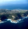
MOSSEL BAY NEWS - The recent rain in the Mossel Bay area has left the municipality no choice but to breach the Hartenbos River with water levels higher than 1,9m. The work was done under strict supervision of an appointed health and safety officer and an environmental control officer.
The current dam levels in the area are as follows (current level as on 11-15 June, last week's level and last year's level):
- Klipheuwel - 41.98%, 43.29%, 51.20%.
- Ernest Robertson 95.93%, 99.72%, 92.73%.
- Wolwedans - 62.53%, 63.07%, 67.43%.
According to the Mossel Bay Municipality, they take great care in managing the breaching of rivers and estuaries. The water levels of the estuaries/ rivers in Mossel Bay, namely Hartenbos; Little Brak and Great Brak, are determined via information provided by the Department of Water and Sanitation. The department's website updates the hydrological (surface water) data for dams, floods and flows and relevant data can be found under the Breede-Gouritz data tab. Water levels is also determined on-site by certain locations along the rivers, which have water level indicators.
Estuaries in Mossel Bay are recognised as particularly sensitive and dynamic ecosystems, and therefore require above-average care in the planning and control of activities related to use and management. The respective national legislation require estuary management plans (EMPs) to be prepared for estuaries in Mossel Bay in order to create informed platforms for efficient and coordinated management.
Each estuary has an EMP which outlines the mouth management protocol. The document clarifies the conditions that necessitate a mechanical breach.
These documents can be found on the municipal website under general documents.
The actual opening of the mouth required an environmental authorisation which the municipality obtained by submitting a mouth management protocol to the Department of Environmental Affairs and Development Planning.
The current water levels of the Great Brak River, which is directly affected by the Wolwedans dam level and the volume of water release, does not require an artificial breaching now and the same goes for Little Brak River. The latter is not often artificially breached as it tends to break through naturally as water levels rise.
However, the municipality monitors it closely and will initiate an emergency channel should water levels pose a flood risk.
The municipality works closely with the respective river forums in its efforts to manage the estuaries. Members of the public are welcome to join these forums which meet quarterly.
For more information contact Mushfiqah Abrahams or Warren Manual of the municipality's Environment Management Section on 044 606 6314/5163.
'We bring you the latest Mossel Bay, Garden Route news'