GARDEN ROUTE | KAROO NEWS -The South African Weather Service (SAWS) has issued an alert regarding an approaching spell of cold, wet and windy weather set to affect large parts of the country from Friday 17 April through to Monday 20 April.
The shift in conditions is linked to the arrival of two successive cold fronts, expected to make landfall over the western regions of South Africa.
These systems will initially impact the Western Cape and Northern Cape before moving eastwards across the central and eastern interior over the weekend.
From Friday, cold, wet and windy conditions are forecast to set in over the western interior, including parts of the Western and Northern Cape.
Significant rainfall is expected in these areas, accompanied by strong winds and a marked drop in daytime temperatures, as reflected in Figures 1 and 2.
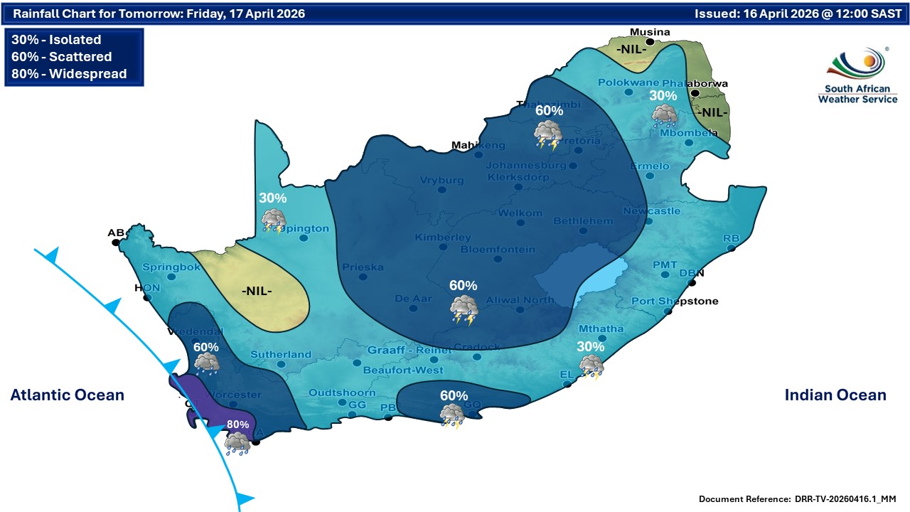
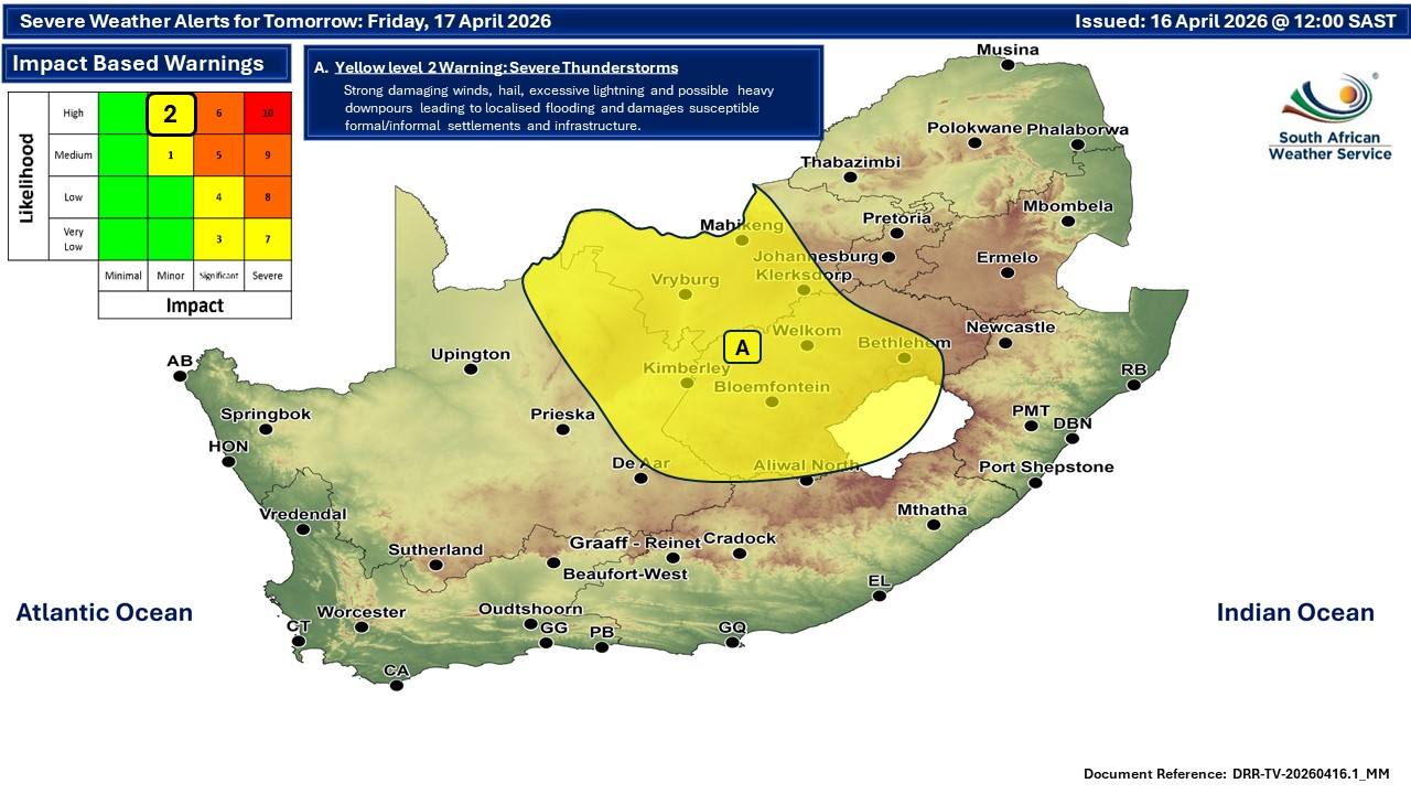
Figure 1:
Weather outlook for Friday, 17 April. (Source: SAWS)
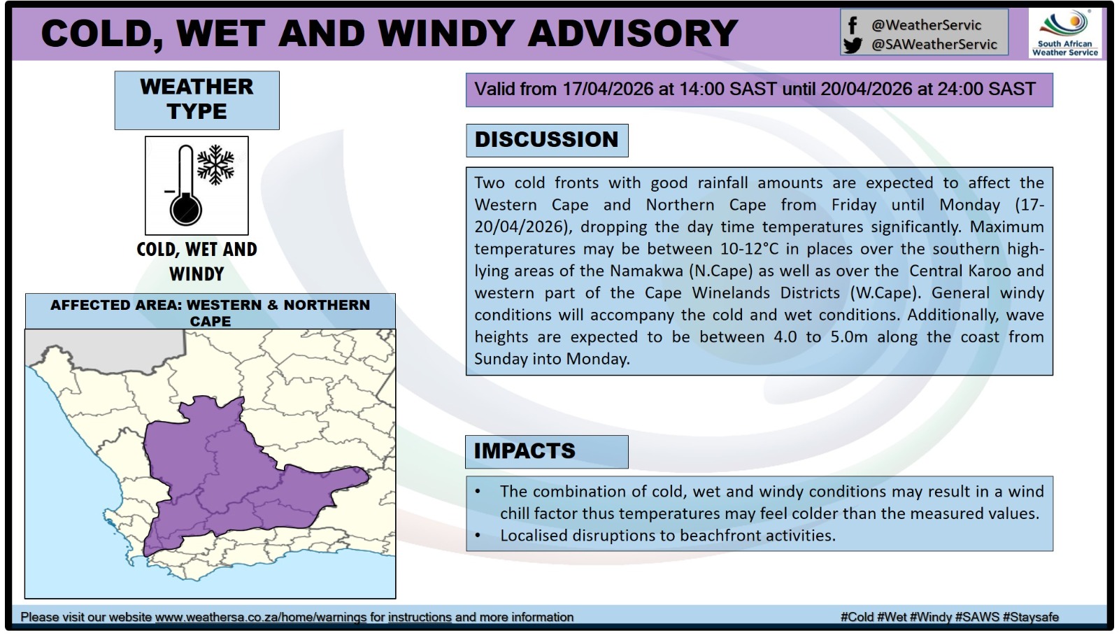
Figure 2:
Advisory for cold, wet and windy conditions. (Source: SAWS)
By Saturday, 18 April, the cold airmass will penetrate further into the central interior, while the cold front progresses further east of the country. Widespread cool to cold conditions are expected across much of South Africa.
Isolated to scattered showers and thundershowers are forecast over the central and eastern provinces, including the Free State, North West, Gauteng, Mpumalanga, and KwaZulu-Natal, as indicated in Figure 3 below.
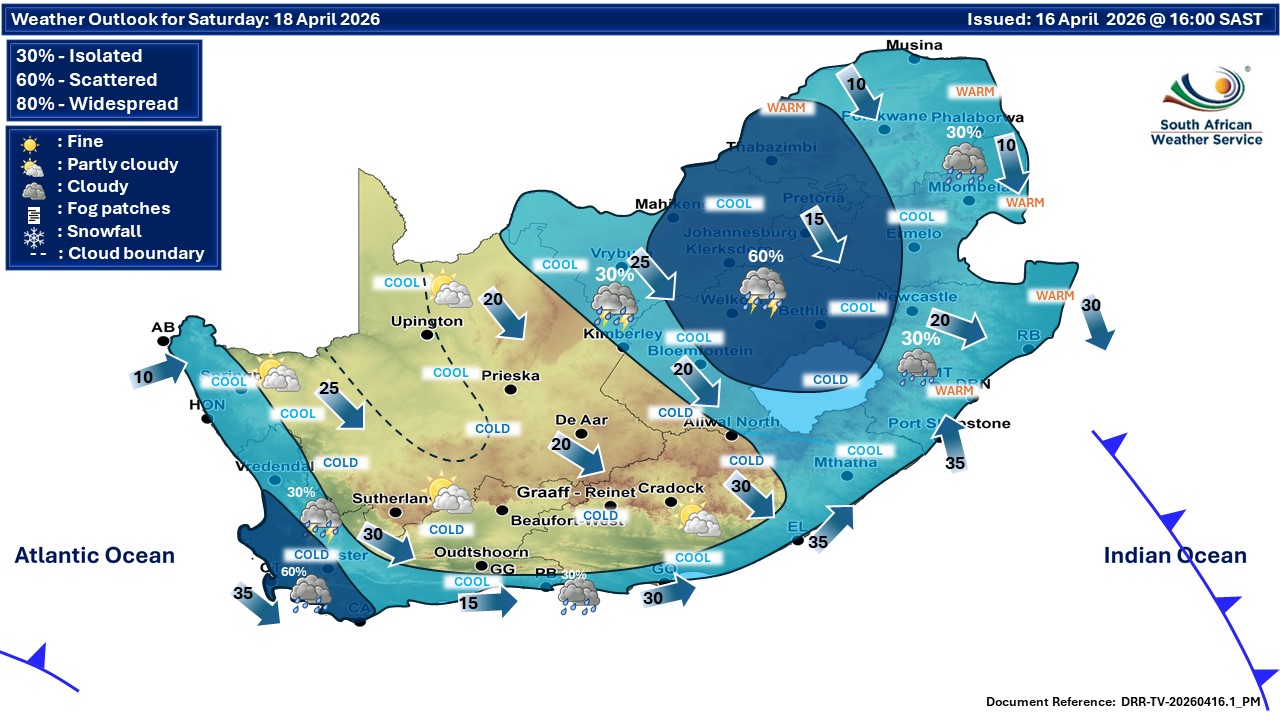
Figure 3:
By Sunday, 19 April, cold, wet and windy conditions will have spread to the eastern and southern parts of the country, including the southern and eastern coastline of South Africa.
Moreover, marine conditions are expected to markedly deteriorate, with wave heights along the coastline forecast to reach between 4,0m and 5,0m from Sunday into Monday, potentially impacting coastal and beach activities.
Weather outlook for Sunday 19 April:
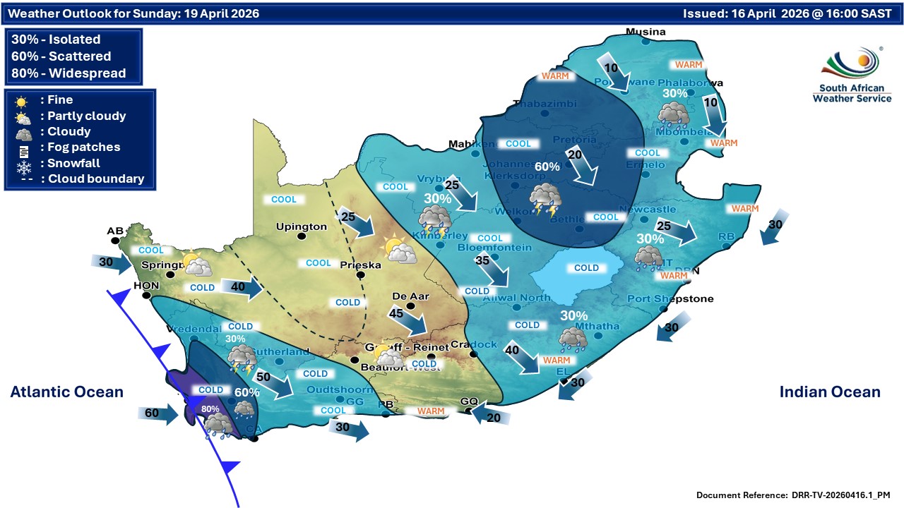
Daytime maximum temperatures are expected to drop significantly, with some high-lying areas in the western interior and adjacent regions possibly experiencing daytime temperatures between 10°C and 12°C.
These conditions, combined with strong winds, will result in a pronounced wind chill effect. By contrast, the northern extremities of the country are expected to remain relatively warm during this period.
Impacts:
- Cold, wet and windy conditions may result in a significant wind chill factor, making temperatures feel colder than measured.
- Localised flooding of low-lying areas and poor drainage systems may occur in regions experiencing persistent rainfall.
- Disruptions to outdoor and beachfront activities are possible due to strong winds and rough seas.
- Reduced visibility and slippery roads may impact travel conditions.
Advisory:
The public is advised to take the following precautionary measures:
- Dress warmly and ensure adequate heating in homes.
- Use heating devices safely to avoid fire hazards.
- Exercise caution when travelling on wet and slippery roads.
- Avoid unnecessary travel during periods of heavy rainfall.
- Secure loose outdoor objects that may be affected by strong winds.
- Stay away from the coastline during rough sea conditions.
- Continuously monitor official weather updates and warnings issued by SAWS.
Members of the public and stakeholders are strongly urged to continuously monitor official SAWS forecasts and warnings. These warnings will be updated regularly as the likelihood and severity of impacts become clearer.
The public are also advised to treat unauthorised or unverified information sources with caution and to refrain from distributing such information further.
For regular updates, please visit here or follow SAWS official media channels.
‘We bring you the latest Garden Route, Hessequa, Karoo news’